 Samarai Murua District
General Information Administration District headquarters: Bwagaoia Number of LLGs: 4 - Bwanabwana Rural, Louisiade Rural, Yaleyemba Rural, Murua Rural Number of wards: 89 About Samarai Murua This district covers a large area of ocean and includes the Woodlark, Marshall Bennet, Budibudi, Louisiade and Engineer Islands. It includes a small portion of the southern end of the mainland, including the area around Samarai islands. Mixed staples and coconut cultivation as well as fishing are the main sources of food with low incomes available for trade of these goods and betel nut. Misima Island once provided income earning opportunities and royalties from the goldmine, however, this has ceased since the closure of the mine.  Kiriwina Goodenough District
General Information Administration District headquarters: Kiriwina Number of LLGs: 2 - Kiriwina Rural, Goodenough Island Rural Number of wards: 61 About Kiriwina Goodenough This district encompasses Goodenough Island (of the d’Entrecasteaux Group) and the Trobriand and Luscany Island Groups. There are opportunities for low incomes to be earned from the sale of betel nut, fish and food (mixed staples). Smaller islands rely on trade for sufficient food.  Moutain range in Esa’ala District Esa’ala District
General Information Administration District headquarters: Esa'ala Number of LLGs: 3 - West Fergusson Rural, Dobu Rural, Duau Rural Number of wards: 88 About Esa’ala Esa’ala District covers the two largest islands of the d’Entrecasteaux Group, Fergusson and Normanby, as well as the smaller Dobu, Sanaroa, Waiope and Neumara islands. Sources of income are limited in this island district, with low to very low incomes earned from the sale of fish, food, betel nut, cocoa and copra. Agriculture is predominantly low intensity, mixed staple cultivation of root crops and coconut with some production of betel nut for sale in markets in Alotau.  Alotau District
General Information Administration District headquarters: Alotau/Rabaraba Number of LLGs: 7 - Makamaka Rural, Daga Rural, Weraura Rural, Maramatana Rural, Huhu Rural, Suau Rural, Alotau Urban Number of wards: 156 About Alotau Alotau District stretches from the mountains at the end of the Owen Stanley Ranges to the coastal areas of the south eastern end of the mainland. Land potential is high in the south of the province, while the north experiences a long dry season and occasional droughts. Businesses in Alotau and oil palm enterprises provide some income-earning opportunities, as well as markets for the sale of fresh food, betel nut and coconut.  Kikori District
General Information Administration District headquarters: Kikori Number of LLGs: 4 - Baimuru Rural, East Kikori Rural, Ihu Rural, West Kikori Rural Number of wards: 76 About Kikori Kikori District encompasses the Great Papuan Plateau and the valleys of the Turama, Kikori and Purari Rivers, which all form a large, common delta on the coast. Moderate potential for agriculture in some of the district's valleys is still constrained by flooding, while the delta area has very low potential for agricultural activity. Income opportunities exist for food production for markets in Port Moresby. 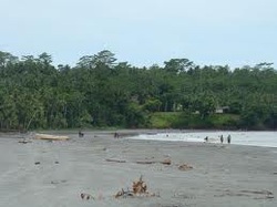 Beach in Kerema District Kerema District
General Information Administration District headquarters: Malalaua/Kerema Number of LLGs: 6 - Central Kerema Rural, East Kerema Rural, Kaintiba Rural, Kerema Urban, Kotidanga Rural, Lakekamu-Tauri Rural Number of wards: 74 About Kerema Kerema District borders Central Province in the east and Morobe Province in the north. It stretches across the Albert and Stanithorp ranges and the Tauri and Lakekamu rivers. The river plains and valleys of the district have a moderate to high potential for agriculture, but are subject to flooding. Some incomes are derived from the sale of food and betel nut locally and in markets in Port Moresby, and some wage employment and royalties are available from forestry. 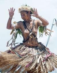 A dancer from Kairuku district Kairuku-Hiri
General Information Administration District headquarters: Bereina/Konedobu Number of LLGs: 4 - Hiri Rural, Kairuku Rural, Koiari Rural, Mekeo Rural Number of wards: 75 About Kairuku-Hiri Kairuku-Hiri district surrounds Port Moresby and stretches from Gulf Province to Gaire Village, south east of Port Moresby. The inland areas in the Owen Stanley Range include the Sogeri Plateau and the area surrounding the Kokoda Track. Port Moresby markets offer high income-earning opportunities for the sale of food and betel nut, however there is also strong population pressure on the flood plains around Bereina and in the settlement areas north of Port Moresby, with high intensity cultivation being practised on land with a poor potential for agriculture. The most disadvantaged communities are those living along the Kokoda Track. The land surrounding these communities has poor agricultural potential and there is poor access to services. 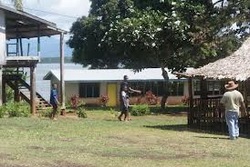 Rigo District
General Information Administration District headquarters: Kwikila Number of LLGs: 3 - Rigo Central Rural, Rigo Coastal Rural, Rigo Inland Rural Number of wards: 67 About Rigo Rigo District is located in the south east of Central Province, and stretches from the coast up into the Owen Stanley Ranges on the border of Oro Province. There are low incomes available from agriculture on the coast, as a long dry season makes the coastal plains unsuitable for intensive agricultural activity. However, many people commute to Port Moresby to earn an income. The most disadvantaged people are those living in the Owen Stanley Ranges who live on land that has a low potential for cultivation and are remote from services. 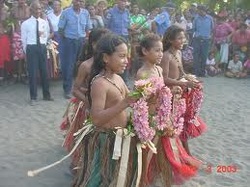 Children in Abau Abau
General Information Administration District headquarters: Abau Number of LLGs: 3 - Amazon Bay Rural, Aroma Rural, Cloudy Bay Rural Number of wards: 40 About Abau Abau district is located in the south east of Central Province. The district covers the coastal areas west of Milne Bay and the mountains and valleys of the Owen Stanley Ranges. There is potential for increased agricultural activities in the coastal plains of the district, especially north of Kupiano, and incomes are high from food sales in the Cape Rodney land settlement area. However, the population living in the coastal swamps and in isolated mountain areas earn low incomes from food, fishing, betel nut, coconut and coffee. The land in these areas has poor agricultural potential. 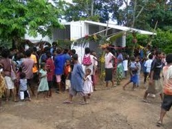 Taipini Station Goilala District
General Information Administration District headquarters: Tapini Number of LLGs: 3 - Guari Rural, Tapini Rural, Woitape Rural Number of wards: 23 About Goilala Goilala District is located in the northern inland area of Central Province, bordering both Morobe and Oro Provinces, and covers the mountains and valleys of the Owen Stanley Ranges. Incomes are moderate and agricultural potential is high in the lower valleys where transportation to markets is available. The upper valleys have low incomes and low agricultural potential because of their steep slopes and poor weather conditions. There is a gold mining operation at Tolukuma, north of Woitape, however, it has little influence on the incomes of the rural population |
AboutOn this page, we provide all the details of the each provinces in PNG. We welcome your critic and contributions. |

- Home
- News
- Business News
- Economy News
- Sports News
- International News
- Corruption News
- Mining Watch
- Jobs
- Education News
- Scholarships
- Health News
- Bzzmart Online Shopping Platform
- Pacific
- Used Cars
- Buy or Rent Homes
-
Travel
- City of Port Moresby
- Adventure and Destination
- Hotels & Lodges in PNG
- Hotels & Lodges in Mendi, Southern Highlands Province
- Hotels & Lodges in Lorengau, Manus Province
- Hotels in Oro Province
- Hotels and Lodges in ESP
- Hotels & Lodges in Kavieng
- Hotels and lodges in Kimbe
- PNG Photo Gallery
- Map of Papua New Guinea
- PNG
-
Computer Tech
- Tech Help
-
Top Weebly designed Websites
>
- HOW TO RECOVER FILES WITH SHORT CUTS OR HIDDEN IN FLASH DRIVE OR EXTERNAL HARD DRIVE
- How to remove Stubborn Computer Virus
- Creating Login or Sign in Membership page in Weebly sites
- How to auto insert Table of Content in Word
- Top Weebly Website Examples and Portfolio
- Weebly Membership Sign in feature available
- Send Free SMS in PNG
- Radio Stations
- Television stations >
- PNG Information Directory
- Computer Resources
- Classifieds
- About us
- Contact Us
- Competition
- Advertisement
- Privacy Policy
- SP PNG Hunters News
- Weebly Forums
- National Football Stadium, Port Moresby
- Work Permits and VISAs in PNG : Guide
- Seasonal Workers Program for PNG
- List Your Business on PNGFacts.com
- Twodot Business Solutions
- Become a Sponsor
- Mt Giluwe Lodge
- Papua New Guinea Defence Force
- Political parties in PNG
- NID PNG
- Employment VISA in PNG
- Business VISA
- Visitor VISA
- Police Clearance in Solomon Islands
- PNG Electoral Commission
- PNG Election Results

 RSS Feed
|
Search Papua New Guinea Database >>
|
|
|
|
|
Home: PNG News :Travel : Government System: Computer Tech : About us: Contact : Disclaimer : Sitemap : Login Copyright & Disclaimer © 2012 -2023 PNG Facts: All rights reserved:
|
Website developed by Kilikalo Technology & Business Solutions Ltd
About |
Terms |
|