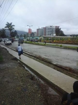
 The District of Hagen covers the Upper Wahgi Valley, the northern areas of the Kubor Range and the south east of the Hagen Range. The district member is Mr. William Duma, of the United Resources Party. He is the current Minister for Mining and Petroleum. This is his second term. Coffee plantations have created higher incomes for people in the Wahgi, Kuna and Komun Valleys. Within this district, agricultural potential is mostly high, incomes are high and access to services is reasonably good, with the exception of the steep slopes of the Hagen and Kubor Ranges. General Information Administration District headquarters: Mt. Hagen Number of LLGs: 2 - Mt Hagen Rural, Mt Hagen Urban Number of wards: 48 Population : 86951 Area and population density Area (km²) 523 Occupied area (km²) 438 Population per km² 166.3 Population per km² of occupied area 198.5 Related Post  People in Mul Baiya District People in Mul Baiya District Baiyer Mul shares a border with Enga Province, where the Lumusa area was once a part of Wapenamanda District. The district includes the Hagen Range and the Baiyer, Lai and Lower Jimi Valleys.
Coffee plantations have created higher incomes for some people in the Middle Baiyer Valley. However, elsewhere incomes are low. There are other areas where the land has high agricultural potential, especially in the Jimi Valley. However, transport infrastructure there is limited. Administration District headquarters: Baiyer Number of LLGs: 3 - Mul Rural, Baiyer Rural, Lumusa Rural Number of wards: 119 Population : 56,686 Area and population density Area (km²) 1376 Occupied area (km²) 751 Population per km² 41.2 Population per km² of occupied area 75.5 Related Post 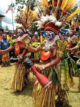 Many dancers from Anglimp South Waghi perform cultural dancers. Photo credti: U.S Air Marshall , Pacific Many dancers from Anglimp South Waghi perform cultural dancers. Photo credti: U.S Air Marshall , Pacific About Anglimp South Wahgi
Angalimp South Wahgi includes the Kubor Range, the Wahgi Valley on the south side of the Wahgi River and Minj Valley. It is in the south east of Western Highlands Province and shares a border with both Simbu and Southern Highlands Provinces. This district will become part of the new Jiwaka Province. Coffee and food sales constitute high incomes for people in the Wahgi and Minj Valleys where wage employment is available on some coffee plantations. There are very low incomes in the more remote Mera area. Administration District headquarters: Minj Number of LLGs: 2 - Angalimp Rural, South Wahgi Rural Number of wards: 80 Area and population density Area (km²) 1970 Occupied area (km²) 528 Population per km² 49.0 Population per km² of occupied area 182.9 Related Post 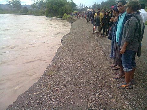 Famous Waghi River flows through Dei District Famous Waghi River flows through Dei District Dei District is in the centre of Western Highlands Province and encompasses parts of the Baiyer Wahgi Divide and the Sepik Wahgi Divide as well as the Wahgi River.
Coffee plantations have created higher incomes for people in the Wahgi Valley and Baiyer Wahgi Divide. Within this district agricultural potential is high, incomes are high and access to services is reasonably good. Administration District headquarters: Dei Number of LLGs: 2 - Kotna Rural, Muglamp Rural Number of wards: 51 Population Total 49767 Area and population density Area (km²) 576 Occupied area (km²) 334 Population per km² Population per km² of occupied area Electoral statistics Eligible voters (2000 Census) 28725 Number of votes cast (2002) 53684 Number of votes cast (2007) 59705 Related Post |
AboutOn this page, we provide all the details of the each provinces in PNG. We welcome your critic and contributions. |

- Home
- News
- Business News
- Economy News
- Sports News
- International News
- Corruption News
- Mining Watch
- Jobs
- Education News
- Scholarships
- Health News
- Bzzmart Online Shopping Platform
- Pacific
- Used Cars
- Buy or Rent Homes
-
Travel
- City of Port Moresby
- Adventure and Destination
- Hotels & Lodges in PNG
- Hotels & Lodges in Mendi, Southern Highlands Province
- Hotels & Lodges in Lorengau, Manus Province
- Hotels in Oro Province
- Hotels and Lodges in ESP
- Hotels & Lodges in Kavieng
- Hotels and lodges in Kimbe
- PNG Photo Gallery
- Map of Papua New Guinea
- PNG
-
Computer Tech
- Tech Help
-
Top Weebly designed Websites
>
- HOW TO RECOVER FILES WITH SHORT CUTS OR HIDDEN IN FLASH DRIVE OR EXTERNAL HARD DRIVE
- How to remove Stubborn Computer Virus
- Creating Login or Sign in Membership page in Weebly sites
- How to auto insert Table of Content in Word
- Top Weebly Website Examples and Portfolio
- Weebly Membership Sign in feature available
- Send Free SMS in PNG
- Radio Stations
- Television stations >
- PNG Information Directory
- Computer Resources
- Classifieds
- About us
- Contact Us
- Competition
- Advertisement
- Privacy Policy
- SP PNG Hunters News
- Weebly Forums
- National Football Stadium, Port Moresby
- Work Permits and VISAs in PNG : Guide
- Seasonal Workers Program for PNG
- List Your Business on PNGFacts.com
- Twodot Business Solutions
- Become a Sponsor
- Mt Giluwe Lodge
- Papua New Guinea Defence Force
- Political parties in PNG
- NID PNG
- Employment VISA in PNG
- Business VISA
- Visitor VISA
- Police Clearance in Solomon Islands
- PNG Electoral Commission
- PNG Election Results
 RSS Feed
|
Search Papua New Guinea Database >>
|
|
|
|
|
Home: PNG News :Travel : Government System: Computer Tech : About us: Contact : Disclaimer : Sitemap : Login Copyright & Disclaimer © 2012 -2023 PNG Facts: All rights reserved:
|
Website developed by Kilikalo Technology & Business Solutions Ltd
About |
Terms |
|